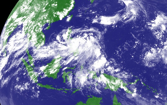
The low pressure area (LPA) spotted Friday morning near east of Borongan City, Eastern Samar, has developed into a tropical depression and was named “Carina”, the Philippine Atmospheric, Geophysical and Astronomical Services Administration (PAGASA) said Friday afternoon.
Moderate to heavy rainfall can be expected within 300 km diameter of the tropical depression.
PAGASA said “Carina” will cause moderate to heavy rains over Bicol, eastern Visayas and CARAGA. This may trigger flashfloods and landslides, PAGASA added.
“Carina” has a maximum sustained winds of 45 kph near the center, and is forecast to move northwest at 11 kph.
The state weather agency said light to moderate rains affecting Albay, Camarines Sur, Catanduanes and Northern Samar Friday afternoon may persist for one to two hours.
There is no tropical cyclone warning signal yet, PAGASA added. (PNA)