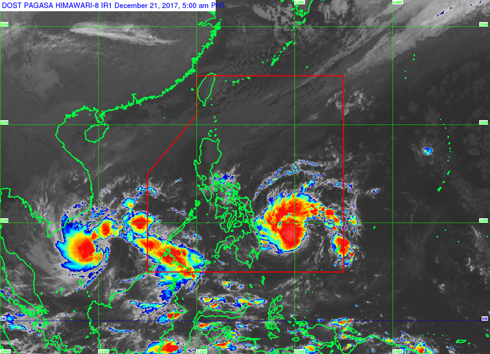
The weather disturbance named “Vinta” further intensified into a tropical storm early on Thursday, while Storm Signal Number 1 will likely be raised over Bohol within the day, said the state weather bureau.
In its bulletin issued at 5 a.m. Thursday, PAGASA indicated that the tropical storm now has maximum winds of 65 kph near the center and gustiness of up to 80 kph.
According to PAGASA, the storm is expected to make landfall over the Caraga and Davao Regions between Thursday afternoon and Friday morning
The center of Vinta was located at 510 km east of Hinatuan, Surigao del Sur as of 4 a.m. today.
It slightly slowed down heading west at 18 kph from 20 kph yesterday.
Storm Signal number 2 has been hoisted over Surigao del Sur.
Meanwhile, Storm Signal 1 number was raised over the following areas:
- Southern Leyte
- Dinagat Islands
- Surigao del Norte
- Agusan del Norte
- Agusan del Sur
- Davao del Norte
- Compostela Valley
- northern Davao Oriental
- northern Davao del Sur
- North Cotabato
- Bukidnon
- Misamis Oriental
- Camiguin
According to PAGASA, sea travel is risky over the eastern seaboard of Visayas and Mindanao due to the approaching tropical storm.
“Scattered to widespread moderate to heavy rains is expected over Eastern Visayas, Caraga and Davao Regions within 24 hours,” said PAGASA. “Residents of these areas must undertake precautionary measures, coordinate with their respective local disaster risk reduction and management offices, and continue monitoring for updates.”

